Virgina Road Trip
by Mitchell Sprinsky on Apr.23, 2006, under Uncategorized

The parking area is actually on private land with a public access road running through. No one screamed at us and the directions said to park there, so we did. Then begins the four mile 1300' fire road climb to the trailhead at the Shenandoah Mountain Trail. Not the starting time of 10:30 AM) We kept thinking why not drive up to the trailhead, and then reality set in. We'd have to climb up to the car at the end of the ride.


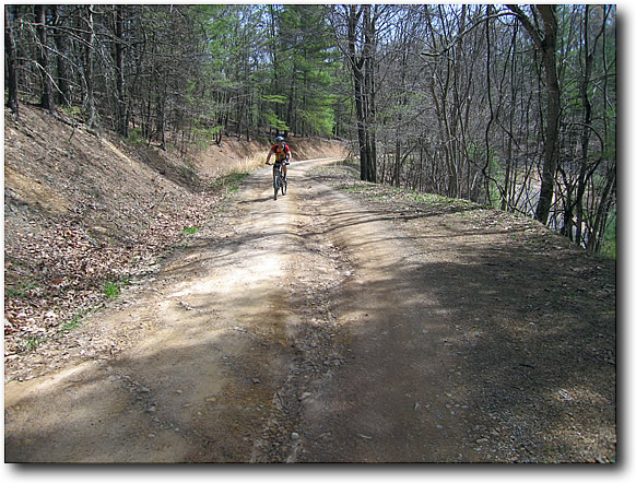
I have to keep telling myself to conserve energy. At times I think I was climbing to fast and not really taking into account how long and hard this ride was going to be. I had one flat along the way in a slime tube. That's not supposed to happen. Change it and continue on.
We reach the top of the fire road, but no the top of the climb.

The trailhead and trail were well marked, signed, and blazed. I never see that in the local trails I ride. The sign clearly shows the bail out point of Jerkemtight Road. Nice name! As you'll read later on, it should have been called Jerkemaround Road.

The trail now climbs another 1000' feet up singletrack and some of it quite technical and exposed. The leaves are 6" deep in some spots making it hard to tell where the rocks are or the edge of the trail for that matter. This is a long hard climb. It's a steeper grade than the fire road and the angle of the trail cut is causing me to use a lot more upper body to balance the right direction. It's fatiguing to say the least.


Once at the top of the bump (3600') it becomes an 11 mile undulating (read mostly climbing) ridge ride of no return. The first part of that starts with a downhill and some ridge riding.

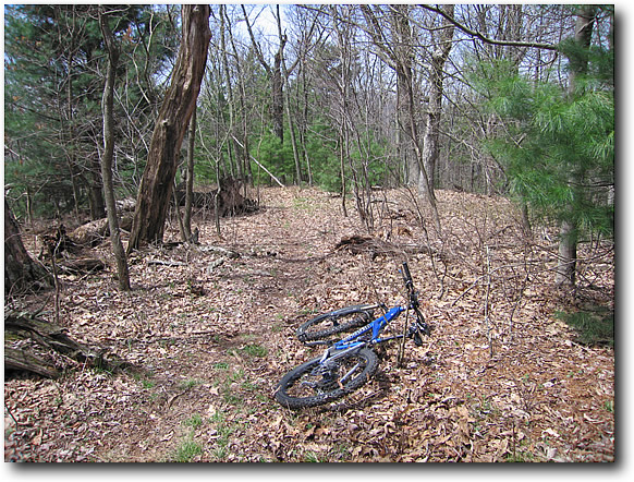

Then some more uphill (a lot more) along the ridge.


We reach the top of another summit and pause to take in the view.

Then it's onto what looks like a long downhill with rocky goodness. I head down a bit to take Roger's picture and the continue bombing.


Lot's of fun but I know it's only temporary as we are only half way. Then toward the end of the DH there are two log overs about 10 feet apart. I am moving at a fairly good pace, my confidence level is high, and I know I can bunny hop both in succession. I hop one, but the trail is steep and I pick up more speed than anticipated in the landing. I go to hop the second and it's too early. BAM! Front wheel into the log and over I go. I land with my fist up under my right rib rack and into my gut. I swear I saw every star in the universe and for the next ten minutes I am trying to catch my breathe and deal with the pain at the same time. Roger comes down the hill and sees me curled up in a ball moaning.
I am hurting bad but nothing is broken, so I suck it up and head off again. About half a mile more I realize the GPS is not attached to my bike anymore. That's not a good thing since we don't have a map, I am slowing down from the pain, and water is now being rationed. Roger heads back up to the crash site to see if the GPS is there and I follow a few minutes later. I thought we were all alone, but he's talking to a group of riders from Montreal Canada and they found my GPS. They asked why were chose this as our first ride of the region. Uh-oh. Then they asked if we had a map. Their reply was an astonished, "You don't have a map?". I pointed to the GPS, but I don't think they understood. They offered to lead us on, but at that point I knew I was not going to have the energy to keep up with them after being hurt. We trailed them until the took a rest and I told them to go on.
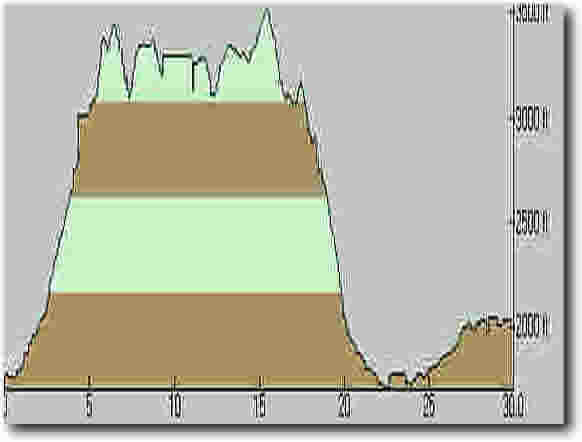
We assessed our situation. It was getting late and so we decided to take the Jerkemtight bail-out. We continue riding the ridge up… up… up… down… up… up… (you the picture). I am looking at the GPS and I see Jerkemtight Road on the screen as well as the trail. At the point where it looks like the connect, I stop and see nothing. Roger says it must be a little further. We ride another two miles and nothing. At this point I say we missed it but I am not going to try and go back. It's very late and I have about two ounces of water left. I can see farms to my right, but no trail down. I see nothing on the center (where we want to go). The GPS is not helping much now as the road I want to get to (629) looks like an eternity from here. The pain in my gut starts eating at my mind and I begin to wonder about survival mode. No matches, lighter, food, water, or flashlight and I'm stuck 3500' above anything and in pain. I press on and suddenly the mountain stops climbing. Could this be it? The five mile ear-to-ear grinning downhill? I look at the GPS and there is 627 connecting to 629 at the end of this DH. Hit it!
I try to go as fast as I can but I am so tired I can't even enjoy it. I also have reality bite me on the ass that it's 10 miles back to the car at the end. Then another whammy hits me as my rear starts sliding all over the trail. Another flat!!! That's not good – no more tubes. I figure I am about half way up still, so I just pump it up and continue down snapping a photo (first one since the crash) before I take off.

Finally we reach 627 and it's all downhill until 629. Still 10 miles to go, flat tire, no phone service, and no water I have to make a judgment call to get up the nerve in deliverance country and ask for water. Another pump up of the tire and I spot an old man sitting on the porch of one of the "nicer" looking homes. He waves, so I think he's friendly and approach. I ask him for water and he asks if I am Johnny. OK, must be a language barrier. I ask again if I could get some water. He tells me he's blind. I am just about to give up, but I ask one more time using words like sink, faucet, and hose along with water. He says sure come in and get what you need telling me it's pure tested well water. OK, I'll deal with the stomach problems later, I say to myself.
I fill up the 'bak all the way, thank him, and even give a god bless (I figure that most of the people around these parts are religiously oriented).
I drink almost a quarter of it before hitting 629 and stopping to try and patch the tube. I send Roger on with the keys and tell him I continue on once the tire is fixed. After fumbling with the pump for 20 minutes (it's new and defaulted to Shraeder), I get the tube patched and head off on a long road haul. About six miles in, Roger meets me with the truck and we head off to the campground, dejected. Thirty seven miles of riding took us 10 hours. My personal worst.
Would I do it again? Sure. But I'll know what to expect and prepare for next time.
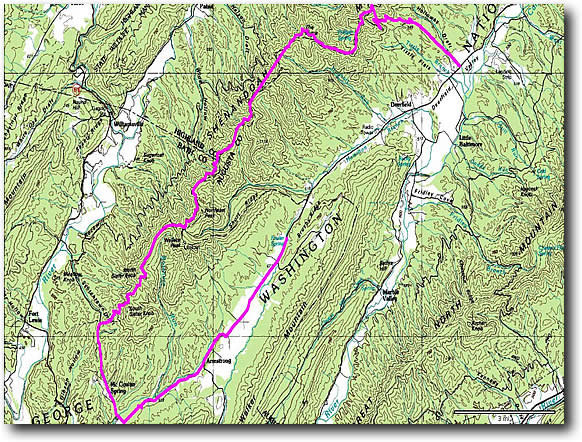
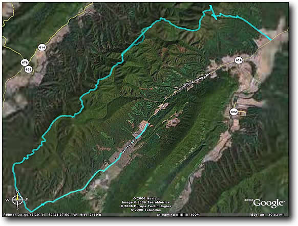
Here's some GPS info. It's a little off because of the crash and getting the unit back. So there is a flat/straight point that is really more down and up.
Day 2
Douthat Intro
After arriving at camp at 10:30 PM, we quickly set up the tent, introduce ourselves to Mike, talk around the fire a few minuted and then head off to bed. Rain starts heading in as we settle down.
Dan and Jeff arrive around 7:30 AM and we setup as the rain stops. Our tent city sprouts on one of the nicest campgrounds I have ever seen.

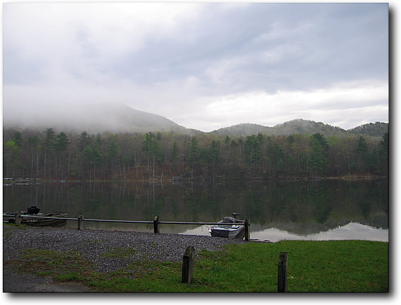


Having an accomplished rider like Mike Dart lead us is a bit intimidating, but he quickly adapts to our abilities and takes us on a short primer of Douthat. Starting with a long haul climb to the top of one of the ridges.


I find myself hanging in the back as my adventure from yesterday has taken a serious toll on my energy along with some breathing difficulties from the pain. Still, I am determined and he leads us on to some lookout spots along more rocky ridge riding.


A little more climbing with well marked trails and then a three mile stretch of smoking downhill back to camp. Mike kicks ass on the DH even in wet rocky and rooty conditions. Short, but enough to kill me for the day as I put on my tour operator hat and make lunch for the gang.


After lunch Jeff, Dan, and Mike head out for another ride. I stay back and nurse my wounds.
Day 3
The rain has been continuous all night long and no exception when we wake up. We decide to give it until 11:00. The trails here are not effected by water except for slippery conditions. You can't put ruts in rock. Just as we are about to call it a wash (pun intended), the rain stops. Procrastinated a bit, we finally suit up and head out and a great 13 mile ride. I skip the camera fearing rain. Mike takes us up a 2000' climb to the highest peak in the park. The climb starts off very technical but the slippery rocks are no match for the Kenda Stick-E's. I am feeling better despite the sticking in my side from a bruised rib. It's humid and I am dressed way too warm, but I complete the climb not far from the front of the pack. Then it's some fun ridge riding to the downhill. Five miles down to camp on a blasting singletrack with rocks, berms, and a rutted washed out finish that does launch after launch. I still haven't been able to uncurl my hands! The smiles on our faces at the end covered in wet dirt says it all!

I am going to have to return and hope the weather is nicer. It would have been great to go a little faster on the DH, but the wet leaves and rocks made it a little sketchy.
Mike was a great host/guide. Another great person I have found to ride with all through the Internet.